Monitoring land degradation / rehabilitation in drylands from space
|
Land degradation, a long-term decline in soil quality and biomass productivity, affects one quarter of the World’s arable lands. The only way to assess degradation processes over large areas without damaging the local vegetation is by remote sensing.
|
|
Land degradation, defined as long-term decline in biomass productivity, is an environmental problem affecting almost one quarter of the World’s arable lands. It has severe economic implications for agricultural and grazing managements. In drylands, land degradation may severely affect the local population that relay upon such services. Therefor, rehabilitating the native vegetation in terms of productivity and improving soil fertility are essential tasks in drylands. However, monitoring decline in biomass productivity due to improper land management is not straightforward. Remote sensing is the only viable way to assess changes in biomass production over large heterogeneous areas without damaging the vegetation cover.
Two main remote sensing approaches were proposed to distinguish climatic from anthropogenic causes of degradation. In the first approach trend analysis on NDVI-based rain use efficiency (RUENDVI) is conducted. The Normalized Difference Vegetation Index (NDVI) is a spectral-based index related to the photosynthetic activity of the vegetation and canopy structure. In drylands, it is highly related to biomass production. Rain use efficiency (RUE) expresses the efficiency of the land to produce vegetation biomass through rainfall amount (i.e. RUE = biomass / rainfall amount). Thus by combining satellite-derived NDVI and rainfall data changes in RUENDVI could be assessed. Basically, a decline in RUENDVI is attributed to human-induced land degradation. The second approach uses the trends on residual technique (RESTREND). RESTREND consists on removing rainfall effects by analyzing trends on the residuals of measured minus expected NDVI (calculated from linear regressions of rainfall vs. NDVI). In this approach positive trends are interpreted as land rehabilitation while negative ones as land degradation. Both trends are attributed to human activity. Yet, it was shown that both approaches could not indicate if human-induced land degradation actually occur when rainfall effect is too strong or satellite-derived time series are too short. To overcome this drawback we proposed a comparative approach. In the comparative approach changes in RUENDVI and/or AGBNDVI (above-ground biomass based on NDVI) are assessed relatively by using abandoned lands as a reference. Through this approach we were able to detected human-induced land rehabilitation / degradation processes in the Northern Negev, Israel for the last two decades. These changes were detected only by the comparative approach while RUENDVI and RESTREND failed to detect them. 
|

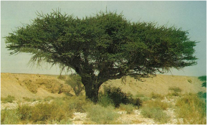
Three management regimes in the Northern Negev: conserved (upper) and abandoned lands (middle), and terrains that underwent contour trenching for afforestation (lower).

Relative changes in productivity (%) in: [a] terrains that underwent contour trenching (red), and [b] a conserved field (green). Vertical line indicates the year when both managements began (1993).
|
